


USDA Ag Atlas Part 1:
Ratios of selected Livestock-to-human beings in certain states
I made a bunch of these maps to have some fun on Twitter, but I wanted to expand on them a bit in this and later posts.
All the data comes from the USDA Ag Census (https://quickstats.nass.usda.gov/). The USDA site has a mapper tool, but it is not very user friendly or good looking at all. They should probably hire me to update it!
Hogs
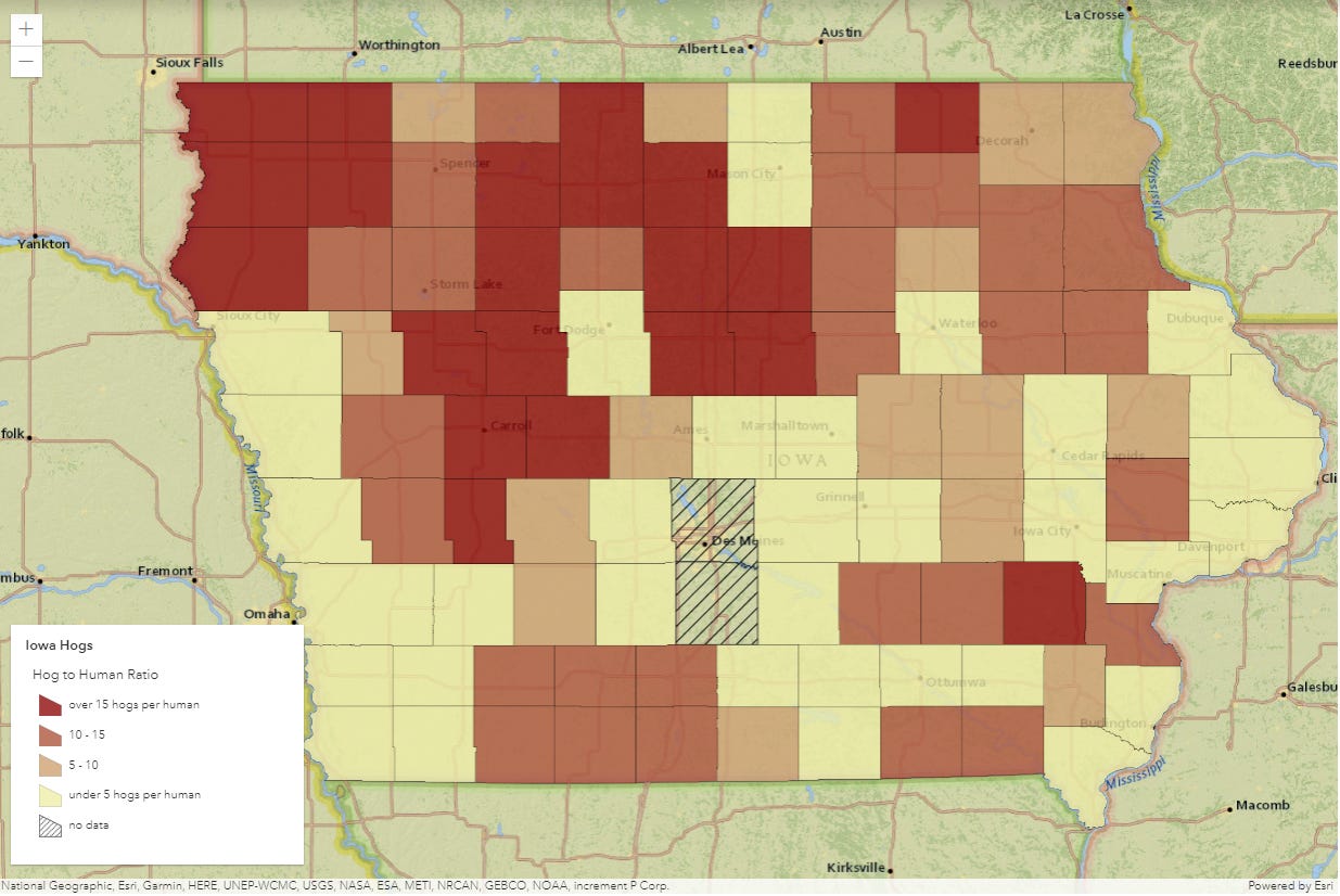
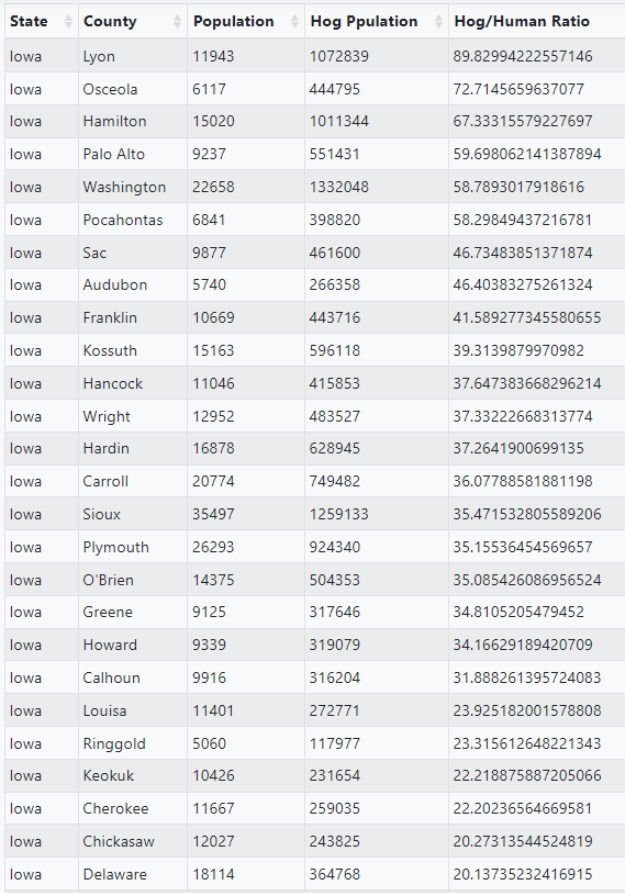
First, let’s start with hogs. Years ago I had a job interview to be the GIS Guy for the City of Mason City, Iowa. I was very poor and living in a trailer with my wife and twins in Helena, Montana and thought Iowa would be a place we could actually afford a house. While this may have been correct, it was not right for us. You’ll see in most of the northern part of the state, hogs outnumber people at a ratio of >15:1. We decided to remain poor in Montana rather than slightly alter this ratio. Nothing against Iowa, but it didn’t have much to offer us. As outdoor enthusiasts, we couldn’t picture our lives in a place with so little public land. You become spoiled in the Western US (and some part of the east) where there is abundant public land for recreation.
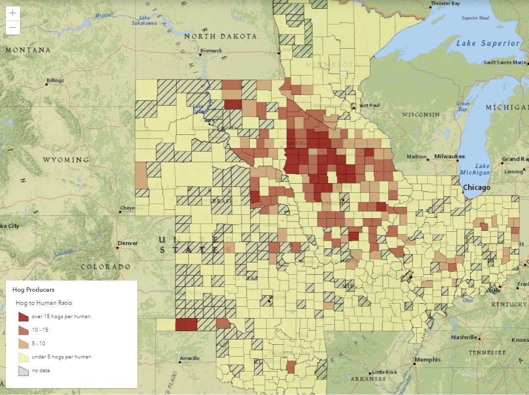
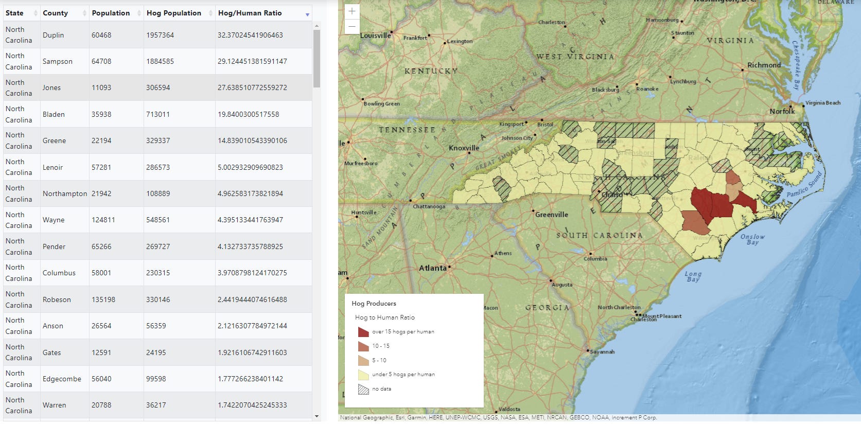
If we zoom, the “hog belt” becomes visible on the map. The other big hog producing state outside of this region is North Carolina, shown below as well.
(note: Mason City Iowa was not where we wanted to live, and I also never heard back following my in-person interview, but the city was nice enough to put me up in the Historic Park Inn, which is a Frank Lloyd Wright building that has been made into a very posh hotel:

The city also has a nice little downtown and a good Thai restaurant.
Cattle
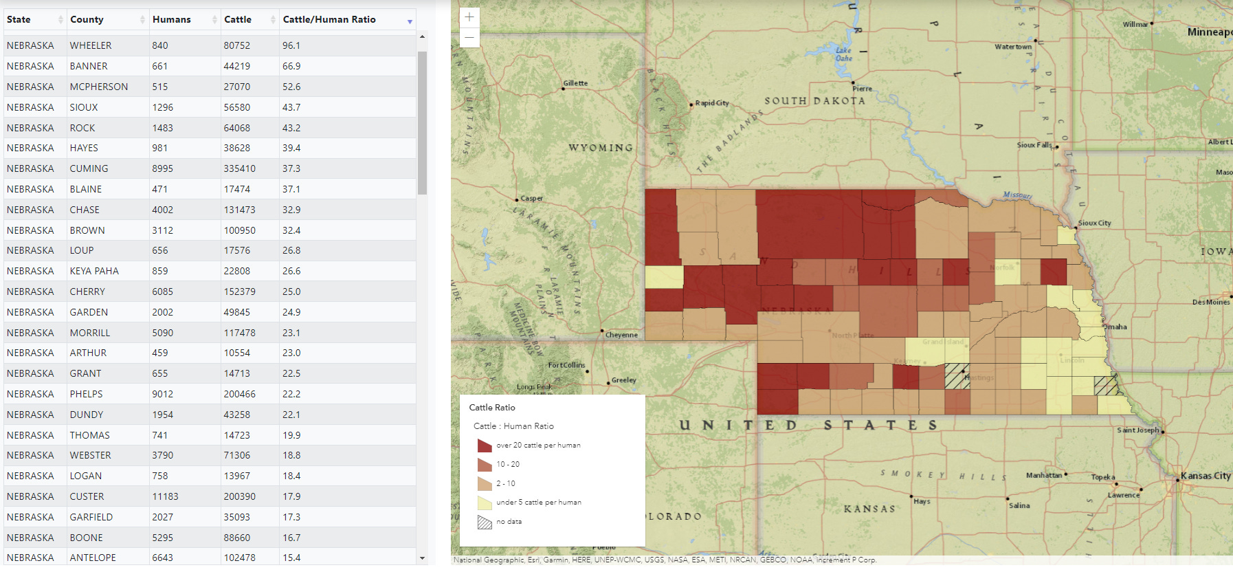
The Great Plains and Rocky Mountain West are well-known as “cattle country” and the strong, independent cowboy will forever serve as a totem in the myth of the American West. So, it comes as no surprise that the Great Plains region is also home to the highest density of Cattle (beef) relative to their human handlers.
The increase in livestock populations and decrease in human population becomes evident as one travels west on any of the major interstates that take travelers from the densely populated east and Midwest through the “empty” Great Plains. The image we have of cows roaming freely across the huge swaths or rolling green plains only explains the high density of cattle to a certain point, however.

Pasture Vs Feedlots
Areas in northern Nebraska’s Sandhills are home to humongous tracts of land with very low human population. If we look at the USDA Ag profile for Cherry County, we see that of the 3.7 million acres of agricultural land, 3.3 million of those acres are non-irrigated pastureland. With only 6,000 human residents and a land profile such as this, it’s easy to see how cattle populations could dwarf humans—while also maintaining the nice mythic “open-space” idyll.


What may come as somewhat of a surprise is that the highest cattle populations and densities occur not in picturesque open pastureland but in concentrated animal feeding operations (feedlots or CAFOs).
Let’s have a look at Haskell County, Kansas, which happens to be the county with the highest ratio of cattle-to-humans at over 100:1.
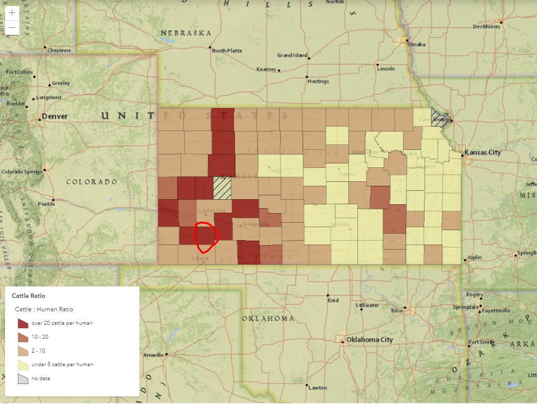
You’ll notice on the land use breakdown below, that unlike Cherry County, NE, this county is dominated by cropland rather than pastureland. So how is this possible? How are there so many cows?
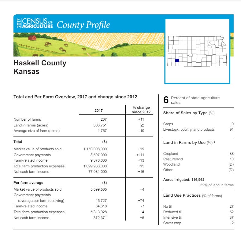
The answer is feedlots. When we look at Haskell County in its entirety, we see mostly a bunch of green circles (which are center pivot irrigation—this tracks with the land use profile in the above chart). I have also circled all the cattle feedlots. With concentrated feedlots, you can stuff half a million cattle into this relatively small county, with enough room leftover to also do a bunch of irrigated crop production. This translates to big money. Haskell County ranked #1 in Kansas for cattle sales—generating ten times the money than all the crop production in county.


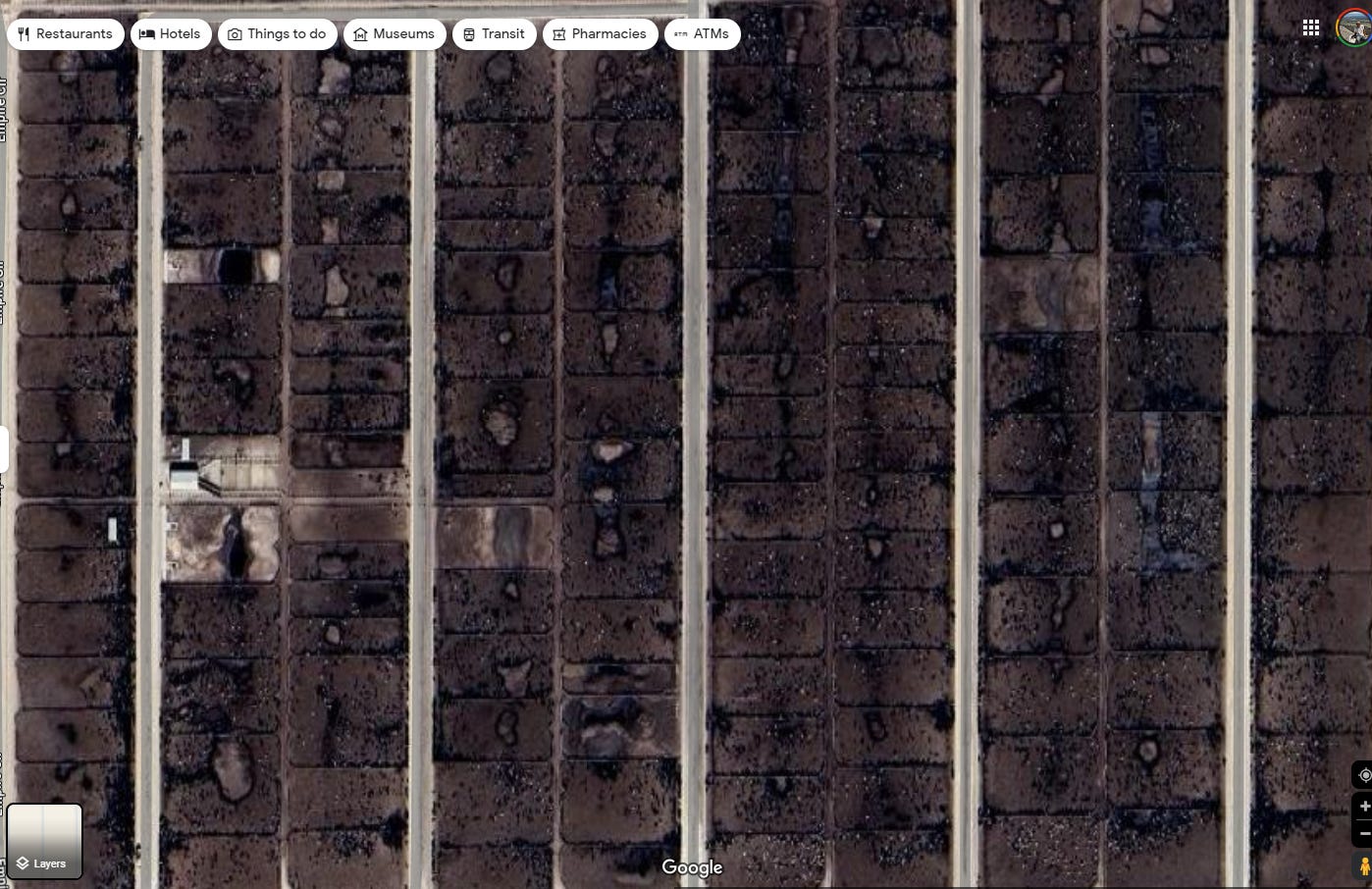
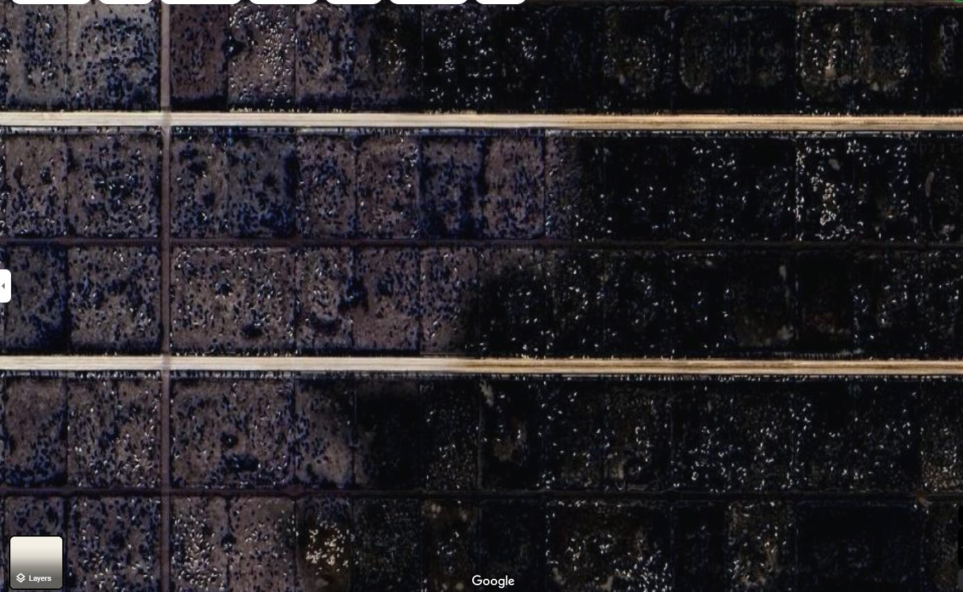
If you’re curious about how feedlots look from the satellite imagery, I’ve selected some from around cattle country. The first one comes from Haskell County, Kansas. I will say, as ugly as these look, they smell even worse! Also, most cattle, even if they start their lives in the open prairies of Wyoming or Montana, they usually end their lives in a feedlot. I’ve talked to many Wyoming ranchers who operate this way—cattle are started in open pasture for a their first few years, but are then sent to feedlots for “finishing,” where they can fatten up on grain feed prior to slaughter.


What also may come as a surprise to some, is that the vast cornfields you see in the American Midwest are not sprouting sweet corn for people to eat but grain corn to be shipped to these feedlots for cattle to eat prior to being processed. While, yes, we do love our sweet corn as well, I think many people do not realize there is a distinction between the two types—it’s all just “corn.” This distinction becomes readily apparent if you’ve ever bitten into a cob of grain corn.
As you drive across Interstate-80, for instance, you’re not looking at huge fields of corn on the cob for your next cookout. They’re essentially beef fields. This map shows the extent of grain corn in the Midwest, which is mainly used for cattle feed, corn syrup production, and ethanol. Not exactly the best use of some of the greatest agricultural land in the world, in my opinion, but consumer demand dictates land use, and we love our cheap beef!
